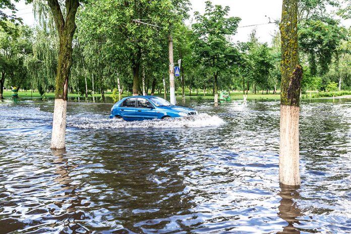
By Stefanie Jackson – Eastern Shore residents provided input for the composition of the Virginia Coastal Resilience Master Plan at an Oct. 13 meeting in the Cape Charles Civic Center, led by Gov. Ralph Northam’s senior advisor to the Secretary of Natural and Historic Resources, Ellen Bolen.
“Science shows us that with climate change, flooding will get worse before it gets better because of rising sea level, increased rainfall, and stronger coastal storms,” stated an information sheet provided at the meeting.
Virginia’s Coastal Resilience Master Plan will aim “to reduce flooding where we can, adapt to it where we can’t, and increase the resilience of our neighborhoods and infrastructure.”
The state plan will identify and address challenges faced by coastal Virginians and seek to coordinate efforts at the local, regional, state, and federal levels.
Participants in the Cape Charles meeting discussed what causes flooding on the Eastern Shore, in their experience, and the challenges they face when flooding occurs.
Phil Goetkin, of Cape Charles, said high tides prevent storm drains from working properly, so high tides and storms are a bad combination when it comes to flooding.
The Shore also is in unusual situation in which a nor’easter can cause more trouble than a hurricane, and a storm that comes up the Chesapeake Bay can be more dangerous than a storm off the East Coast, he said.
Cora Johnston Baird, director of UVA’s Anheuser-Busch Coastal Research Center, in Oyster, said that flooding also comes up from the water table (the layer of soil between the groundwater and the land’s surface) and causes septic systems to fail.
Participants also noted a lack of infrastructure leaves many residents at-risk from the effects of flooding. Often, there is only one road leading in and out of a community, and the residential area is miles from the main highway, Route 13.
For example, Carole Brooks noted that Occohannock Neck Road is the only road to Silver Beach, 10 miles from the highway, and it floods frequently because the fields are higher than the road.
Furthermore, during a storm, residents may lose power, internet, and cellphone service, leaving them with the local radio station as the only way to stay informed, she said.
Johnston said most of the Shore’s “critical infrastructure” is on the highway, down the middle of the peninsula, where the land tends to be higher and more “stable.” The problem is whether or not residents can get to the highway or emergency vehicles can reach their communities, she said.
Bolen asked participants to identify reasons why people may not evacuate in the event of a major flood.
Among the answers were avoiding abandoning pets, protecting property, and lacking communication or helpful information resources.
Sue Mastyl added evacuation isn’t always possible because Route 13 easily can become “gridlocked.”
There are only two directions in which Eastern Shore residents can evacuate – north and south – and heading south leads directly to the Chesapeake Bay.
Rick Hubbard asked why people should leave the Shore when the weather conditions at their destination could be worse.
Bolen followed up with advice on how to know when flood waters are too high and travelers should turn around: as few as six inches of fast-moving water can knock down an adult, 12 inches can overpower a small car, and most SUVs and trucks can withstand no more than 18 to 24 inches of water.
More information on flooding and storm preparedness is provided by the Virginia Department of Emergency Management (VDEM) and the National Weather Service, part of the National Oceanic and Atmospheric Administration or NOAA.
VDEM provides a map of flood zones categorized by letters A through D, with Zone A having the highest flood risk and Zone D having the lowest risk.
Eastern Shore residents can find out which flood zone they live in by visiting www.vaemergency.gov/know-your-zone, clicking on the red button to “Go to Map,” and entering their residential addresses.
They also may visit www.weather.gov/wrn/ to learn about the National Weather Service’s Weather-Ready Nation program.
Another resource is the Virginia Community Flood Preparedness Fund of the Virginia Department of Conservation and Recreation, which provides funding to Virginia localities to develop individualized flood resilience plans.
An incorporated town can apply, and a county can apply on behalf of an unincorporated community.
Public input will continue informing professionals designing Virginia’s Coastal Resilience Master Plan. To take a survey or find more information on the project, visit www.virginia.gov/coastalresilience
Additional options for submitting input on the plan include emailing [email protected] and following the Secretary of Natural Resources (@NatResources) on Twitter and adding the tag #VACRMP to questions or comments.


