


|
|
|||
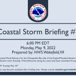
Staff Report —
The following is a briefing from National Weather Service Wakefield, Va., as of 6 p.m., Monday, May 9, regarding the coastal storm continuing tonight through mid-week.
Overview and Impacts:
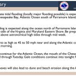
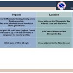
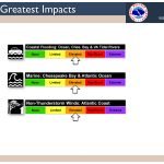
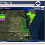
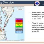
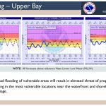
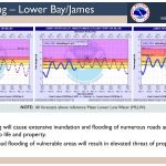
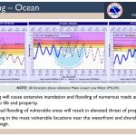
- Primarily moderate tidal flooding (locally major flooding possible) is expected along the shores of the Chesapeake Bay, the Atlantic Ocean south of Parramore Island, and Virginia tidal rivers.
- Minor tidal flooding is expected along the ocean north of Parramore Island as well as the Chesapeake Bay side of the Virginia and Maryland Eastern Shore. Be prepared for water levels to be well above astronomical high tides through mid-week.
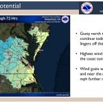
- Winds may gust to as high as 45 to 50 mph near and along the Atlantic coastline tonight through Tuesday morning.
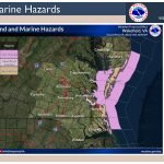
- Gale conditions continue for the Atlantic Ocean, the mouth of the Chesapeake Bay, and Currituck Sound through Tuesday. Gale conditions continue into tonight for the rest of the Chesapeake Bay.
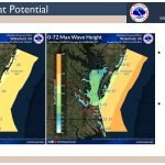
- Large breaking waves will also lead to dune and beach erosion along the Atlantic coast.
Click on the first slide to start the briefing.

Check Links Below For Updates:
Questions?
Call NWS at 757-899-5734
@NWSWakefieldVA facebook.com/NWSWakefieldVA


