


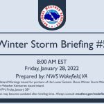
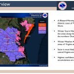
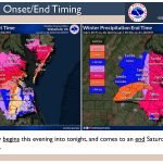
The National Weather Service in Wakefield, Va., has issued an updated briefing as of 8 a.m. Friday, Jan. 28, regarding the upcoming winter storm this evening (Friday, Jan. 28) into Saturday.
Threats:
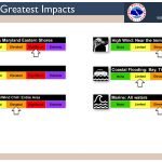
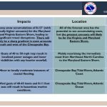
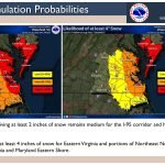
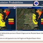
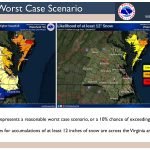
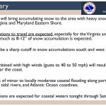
- Significant disruptions to travel are expected, especially for the Virginia and Maryland Eastern Shore where as much as 8 to 12 inches (with locally higher amounts) of snow accumulation is expected.
- There will likely be a sharp cutoff in snow accumulations south and west of the Chesapeake Bay.
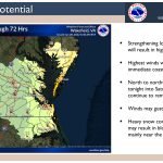
- Heavy snow combined with high winds (gusts to 40 to 50 mph) may result in blowing and drifting snow, mainly near the coast.
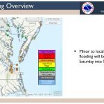
- There is a threat of minor to locally moderate coastal flooding along portions of the Chesapeake Bay, tidal rivers, and Atlantic Ocean coastlines.
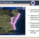
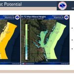
- Gale conditions are expected for coastal waters tonight through Saturday night.
Timing: This evening into Saturday afternoon
Location: All of the forecast area has the potential to see accumulating snow, but the highest amounts/highest impacts will likely be along the coast/Chesapeake Bay and especially for the Eastern Shore of Virginia and Maryland.
Click on the first image below to start briefing.


Check links below for updates:
Questions?Call the NWS at 757-899-5734.


