


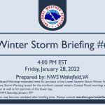
Staff Report —
The National Weather Service in Wakefield, Va., has issued an updated briefing as of 4:05 p.m. on Friday, Jan. 28, regarding the upcoming winter storm this evening into Saturday.
Threats:
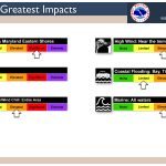
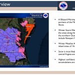
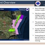
- Blizzard Warnings have been expanded west across the Maryland and Virginia Eastern Shore.
- Winter Storm Warnings have been expanded to include Newport News.
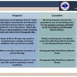
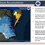
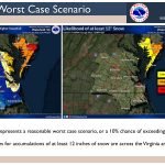
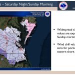
- Significant disruptions to travel are expected, especially for the Virginia and Maryland Eastern Shore where as much as 8 to 12 inches of snow accumulation is expected.
- There will likely be a sharp cutoff in snow accumulations west of the Chesapeake Bay.
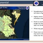
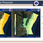
- Heavy snow combined with high winds (gusts to 40 to 50 mph) may result in blowing and drifting snow, mainly near the coast.
- There is a threat of minor to locally moderate coastal flooding along portions of the Chesapeake Bay, tidal rivers, and Atlantic Ocean coastlines.
- Storm conditions for the northern coastal waters and Gale conditions for the rest of the local waters are expected tonight through Saturday night.
- A freezing spray advisory is in effect from Saturday evening through early Sunday.
Timing: This evening into Saturday afternoon.
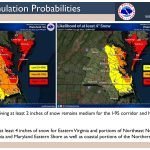
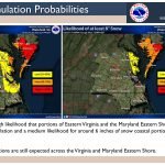
Location: All of the forecast area has the potential to see accumulating snow, but the highest amounts will likely be along the Chesapeake Bay and especially across the Eastern Shore.
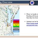

Check links below for updates:
Questions?Call us at 757-899-5734


