


Staff Report —
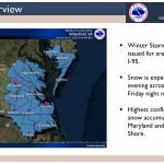
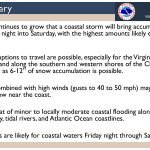
The National Weather Service has issued a new winter storm briefing as of 8 a.m. Thursday, Jan. 27, in regards to the potential winter storm Friday evening into Saturday.
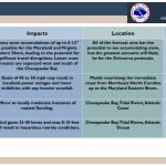
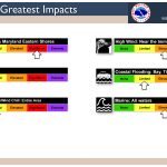
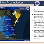
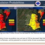
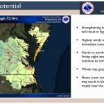
A winter storm watch has been issued, which includes all of the Eastern Shore of Virginia, for 6 to 10 inches of snow, with locally higher accumulations possible, and winds gusting to 45 mph. Travel could be very difficult and gusty winds could down tree branches.
Threats:
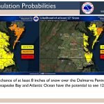
- Significant disruptions to travel are possible, especially for the Virginia and Maryland Eastern Shore and along the southern and western shores of the Chesapeake Bay where as much as 6-12″ of snow accumulation is possible.
- Heavy snow combined with high winds (gusts to 40 to 50 mph) may result in blowing and drifting snow, mainly near the coast.
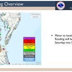
- Minor to locally moderate coastal flooding along portions of the Chesapeake Bay and Atlantic Ocean coastlines.
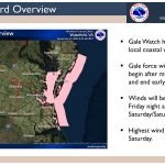
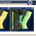
- Gale conditions are likely for the coastal waters.
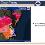
Timing: Friday evening into Saturday afternoon.
Location: All of the forecast area has the potential to see accumulating snow, but the highest amounts/higher impacts will likely be east of Interstate 95 and especially over the Eastern Shore.
Click on the first image below to start the briefing.

Check links below for updates:
Questions?Call the NWS at 757-899-5734.


