


Staff Report —
The National Weather Service in Wakefield, Va., has issued a briefing for continued tidal flooding and hazardous marine conditions expected through today. Gusty northeast winds will continue through this morning and slowly decrease this afternoon as a strong low-pressure system moves offshore. Gale-force gusts will continue across portions of the marine this morning, decreasing this afternoon area. For the latest tide forecasts visit the NWS Coastal Flood Webpage
Key Points:
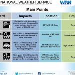
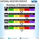
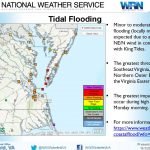
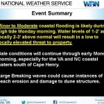
- Tides will remain high today especially with the High tide. Tides will slowly start to decrease after today’s high tide.
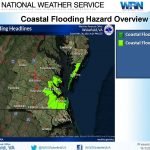
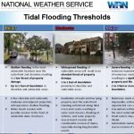
- Middle and upper bay: Minor/shallow flooding in the most vulnerable locations near the waterfront and shoreline will result in a low threat of property damage.
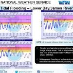
- Lower Bay/tidal James River: Tides will again reach Minor flooding and widespread flooding of vulnerable areas with today’s high tide.
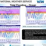
- Northampton County coastline south across the Outer Banks: Moderate to major flooding will cause extensive inundation along the coast. Waves of 8 to 12 feet will result in extensive wave runup causing some erosion of dune structures.
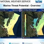
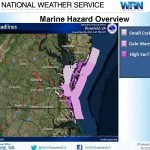
- Marine Weather – Gale conditions will persist this morning gusting up to 35 knots. Winds decrease through the afternoon. Seas will remain elevated around 7 to 12 feet today and 6 to 8 feet Tuesday.
Click on the first image to start the briefing.


Check links below for updates:


